A unique, floating, GPS-enabled device developed at QUT that could act as an early flood warning system will be further advanced with an ARC Linkage grant in partnership with Sunshine Coast Council.
The device, dubbed the Bob-Buoy, developed by Associate Professor Richard Brown from QUT’s Science and Engineering Faculty, can measure and record the direction, velocity and volume flow rate of rivers and creeks. It has been developed in collaboration with QUT’s Professor Yanming Feng and Dr Helen Fairweather from the University of the Sunshine Coast.
Spurred by the devastation of the 2011 south-east Queensland floods, Professor Brown, a fluid mechanics expert, said the aim of the ARC project was to develop a real-time flow logging device equipped with sensors that could also gather water quality data.
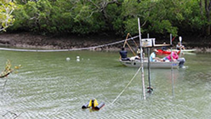
“The Bob-Buoy is one of only a few moving instruments we know of that has been developed to measure water flow in rivers and estuaries,” Professor Brown said of the small, round, capsule that’s fitted with GPS and an inertial measurement unit (accelerometer and a gyroscope in one).
“It will also be capable of ongoing monitoring of water quality through a wide range of sensors that will monitor amounts of dissolved oxygen, nitrates, phosphates, pH, turbidity and chlorophyll – all indicators of water health.”
Professor Brown said measuring water flow with a moving instrument called for a whole different mathematical framework because it provides very different data from a fixed water monitoring system.
“The data we can collect from the Bob-Buoy includes flow rate of water but also depth and water quality which is of value to farmers and irrigators,” he said
“That’s why we are partnering with Sunshine Coast Council as well as river catchment groups to develop this device which will eventually help their members manage rivers, estuaries and canals.
“This device also has many potential applications apart from flood and river monitoring such as study of natural processes in estuaries, estimation of pollution dispersion in reservoirs and lakes, monitoring of waves caused by boats, ships or wind and water usage in irrigation/agriculture.”
Dr Fairweather, with University of the Sunshine Coast academics Professor Roy Sidle and Dr Adrian McCallum, will record the Bob Buoy data and use it to calibrate hydrodynamic models.
“This device is a game-changer when it comes to monitoring water flow and levels, providing a big improvement over the previously restricted stationary method of measuring these variables,” Dr Fairweather said.
Environment Portfolio Councillor Jenny McKay said Sunshine Coast Council was excited to be involved in the development of this significant device.
“The data we can collect from Bob-Buoy can be beneficial in many different ways, but will be particularly important for emergency situations like keeping people safe during flooding,” Cr McKay said.
During the January 2011 floods Professor Brown and Professor Hubert Chanson (from University of Queensland) bravely tied themselves to a safety point in the QUT Gardens Point carpark as the Brisbane River inundated the area to conduct what was thought to be the world's first real-time data collection in a major flood in an urban area.
“We were surprised by the very large fluctuations in the velocity of the water," Professor Brown said.
"One moment the velocity of the water was measured close to zero where an average person could stand up, yet within one minute it could increase up to 1.8 metres per second.”
He said analysis of 48 hours of flood data showed the importance of measuring velocity fluctuations and the direction of water which had led to his development of the Bob-Buoy.
“In the Brisbane floods we discovered the water’s path is not constant – it varies according to height and whether the water is rising or falling.
“In emergency situations the Bob-Buoy can be dropped into the water by helicopters at any point and collect vital data not available to fixed monitors as they go where the water goes, for example, to collect critical data, such as to decide if a town needs to be evacuated.”
Professor Brown said Queensland had 400 surface water gauges for monitoring 75 rivers basins.
“But they can’t be everywhere and can be put out of action by large flood debris.”
He said the Bob-Buoy was still in the experimental phase and that when completed it would be able to transmit real-time data.
“We are also investigating retrieval methods and giving it the ability to untangle from debris,” Professor Brown said.
Media contacts: Niki Widdowson, QUT Media, 07 3138 2999 or n.widdowson@qut.edu.au
Gillian Griffiths, Sunshine Coast Council communication officer, 07 5441 8336 gillian.griffiths@sunshinecoast.qld.gov.au
Terry Walsh, University of the Sunshine Coast media relations manager, 07 5430 1160 twalsh@usc.edu.au


